SIS, a consortium comprising Fininc and Sacyr, will build and manage this project for 25 years, which will require an investment of €517 million. More info
Lousiana I-10 highway awarding.
USA Strategic Market
A world-class consortium comprised of Sacyr, Acciona and Plenary Americas have signed a P3 project to design, build, finance, operate and maintain for 50 years the construction and improvement of a 10-km-long stretch including a new bridge. More info
Northern Chile Airport Network
Chile
The contract covers the operation and expansion of the Antofagasta and Atacama airports. This P3 calls for an investment of €266 million and has a concession term of 26 years. More info.
Peripherical Ring Road
Peru
We are developing a major 34.8 km urban motorway that will improve Lima's connectivity. The concession includes the design, financing, construction, management and maintenance of the road. More info.
Info:The document preview may not show all pages. Download it to see the full document.
Info:The document preview may not show all pages. Download it to see the full document.
SACYR, S.A. announces call notice of the Group’s 9M 2026 results presentation.
21/10/2026
The results will be released on Tuesday, November 3rd, 2026, after market close in CNMV and in our website.
The results presentation will be held on Wednesday, November 4th, 2026, at 12:00h (CET) by audio-webcast in real time, accessible via this link.
Access to the presentation of results replay will also be available directly at the link above.
Share:
Featured projects
0 Subfolders
1 Article
0 Folders
2 Documents
SacyrNewsBricks That Turn Waste Into Sustainable Construction
Share:
Bricks That Turn Waste Into Sustainable Construction
We’re using an innovative solution—bricks made from construction waste—to build the new Velindre Cancer Centre (Wales), one of the most sustainable hospitals in the United Kingdom.
22/10/2026
We’re incorporating a pioneering solution into the construction of the new Velindre Cancer Centre in Cardiff (Wales, United Kingdom): bricks made from construction waste.
In 2023, the Scottish firm Kenoteq won our open innovation program, Sacyr iChallenges. The collaboration between the two companies led to the creation of the K-Briq brick, which is now helping Velindre become one of the most sustainable hospitals in the United Kingdom.
“This technology, developed to promote the circular economy, has found a real-world application in a flagship Sacyr project,” explains Vincenzo Nigro, Technical Manager at the Velindre Cancer Centre.
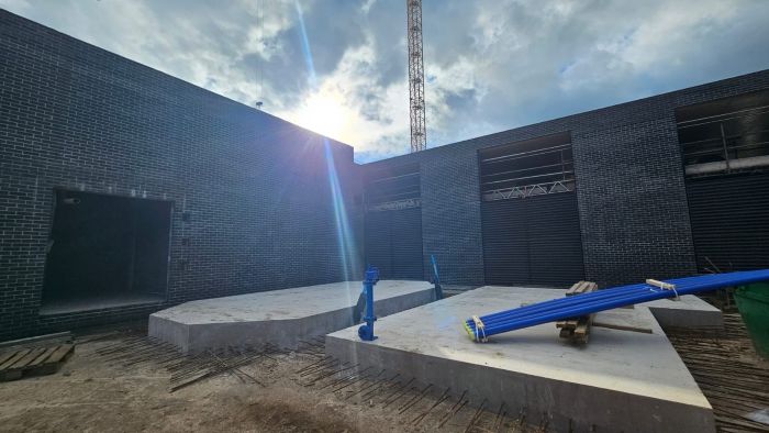
The hospital will incorporate approximately 1,000 m² of these low-carbon-footprint bricks, equivalent to about 60,000 units and more than 151 metric tons of material.
“What makes K-Briq particularly innovative is its composition. These bricks are made from more than 90% recycled construction and demolition waste, which eliminates the need for new raw materials,” adds Vincenzo.
Its production process eliminates the traditional firing of ceramic bricks, drastically reducing the energy required for manufacturing and bringing its carbon footprint to less than 5% of that of a conventional brick.
Their performance has been verified through tests conducted in accordance with various British and European standards and is backed by BBA Agrément Certificate 25/7367.
These tests certify aspects such as their mechanical strength, fire performance, durability, and resistance to moisture, confirming their suitability for use in construction. Furthermore, the bricks maintain their performance even after freeze-thaw cycles, a critical factor for their use in the United Kingdom.
At the new Velindre Cancer Centre, the bricks will be installed in the Service Yard, the utilities area, and the Facility Management area. Their use will have a significant impact on the project’s overall sustainability.
“Examples like this demonstrate that open innovation is a key tool for accelerating the sustainable transformation of the construction industry. It allows us to identify, validate, and incorporate solutions that reduce the environmental impact of construction without compromising technical performance,” concludes Vincenzo.
SacyrNewsDriving more sustainable pavement solutions
Share:
Driving more sustainable pavement solutions
On the Eresma Expressway (A-601) in Segovia, we used recycled material from the road surface that we removed to renew the wearing course. The project incorporates 30% milled material.
23/09/2026
Sacyr Concesiones is putting circular pavement maintenance to the test on the Autovía del Eresma (A-601). Along a one-kilometer stretch, the concessionaire has reused milled asphalt from the existing roadway as feedstock for a new surface course.
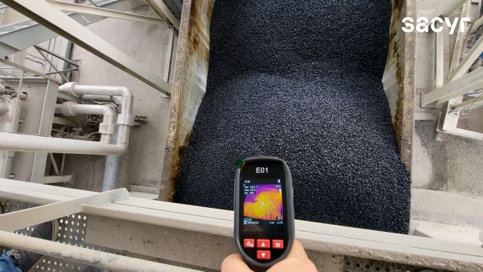
The paving works incorporate 30% reclaimed asphalt pavement (RAP) from the highway’s aged wearing course into the new bituminous mix—double the 15% currently recommended by regulations for this type of layer.
A field test with long-term potential
The pilot section, located between kilometer markers 81 and 82 in direction to Segovia, is designed to prove that today’s recycled asphalt technology can increase RAP content in surface mixes without compromising ride quality, durability or overall pavement performance.
“On this pilot section, we are cutting the amount of virgin aggregate needed in the mix,” said Miguel Ángel Moreno, from Sacyr Concesiones’ Pavements Department. “We also reduce material sent to landfill and lower the carbon footprint associated with asphalt production,” he added.
The trial will allow the team to track the mix in service, monitor its long-term behavior and assess whether the approach can be scaled to future maintenance campaigns.
“We want to see how this mix holds up in the field and whether the solution is sustainable, technically viable and cost-effective over time,” said Ángel Delgado, manager of the Autovía del Eresma.
Technology and collaboration drive the pavement trial
The recycled asphalt mix—a BBTM 11B gap-graded surface mix with 30% RAP—was manufactured at Padecasa’s plant in Aldeavieja, Ávila.
The project brings together the Regional Government of Castile and León, Sacyr’s Pavements Department, Sacyr Concesiones’ Innovation team and Padecasa. It builds on a 2024 test section that used 15% RAP, the maximum share currently recommended for this type of wearing course.
The initiative supports circular economy targets and aligns with Castile and León’s regulatory framework, which requires at least 3% of aggregates used in pavement rehabilitation works to come from recycled materials.
With pilots like this, Sacyr continues to test lower-impact road maintenance solutions that conserve natural resources, reduce waste and support more sustainable infrastructure management.
This website uses its own and third-party cookies to improve the user experience and analyze their behavior in order to improve the service offered.
You can consult additional information about the cookies installed on our Cookies policy.
These cookies are exempt from compliance with article 22.2 of the LSSI in accordance with the recommendations indicated by the European authority on privacy and cookies. In accordance with the above and although configuration, acceptance or denial is not possible, the editor of this website offers information about them in an exercise of transparency with the user.
Name: LFR_Session_STATE_*, Provider: Liferay, Purpose: Manages the session as a registered user , Expiration: Session, Type: HTTP
Name: GUEST_LANGUAGE_ID, Provider: Liferay, Purpose: Determines the language with which you access , to show the same in the next session, Expiration: 1 year, Type: HTTP
Name: ANONYMOUS_USER_ID, Provider: Liferay, Purpose: Manages the session as an unregistered user , Expiration: 1 year, Type: HTTP
Name: COOKIE_SUPPORT, Provider: Liferay, Purpose: Identifies that the use of cookies for the operation of the portal, Expiration: 1 year, Type: HTTP
Name: JSessionID, Provider: Liferay, Purpose: Manages login and indicates who is using the site, Expiry: Session, Type: HTTP
Name: SACYRGDPR, Supplier: Sacyr, Purpose: Used to manage the cookie policy , Expiration: Session, Type: HTTP
ANALYTICS
These cookies allow us to count visits and sources of circulation in order to measure and improve the performance of our site. They help us know which pages are the most or least popular, and see how many people visit the site. All the information collected by these cookies is aggregated and, therefore, anonymous.
Name: _ga_<container-id>, Provider: Google, Purpose: Collects data about the number of times a user has visited the website in addition to the dates of the first and most recent visit. Used by Google Analytics, Expiration: 2 years Type: HTTP
Name: _ga, Provider: Google, Purpose: Registers a unique ID that is used to generate statistical data about how the visitor uses the website, Expiration: 2 years Type: HTTP